New GeoJSON and Shapefile Viewer
I'm thrilled to share that we've just added two completely free viewers to make working with map files painless:
No installs, no sign‑ups, no fuss. Just open the link, drop your file, and you're in.
Give them a whirl!
- GeoJSON Viewer - Perfect for viewing GeoJSON files with all feature properties
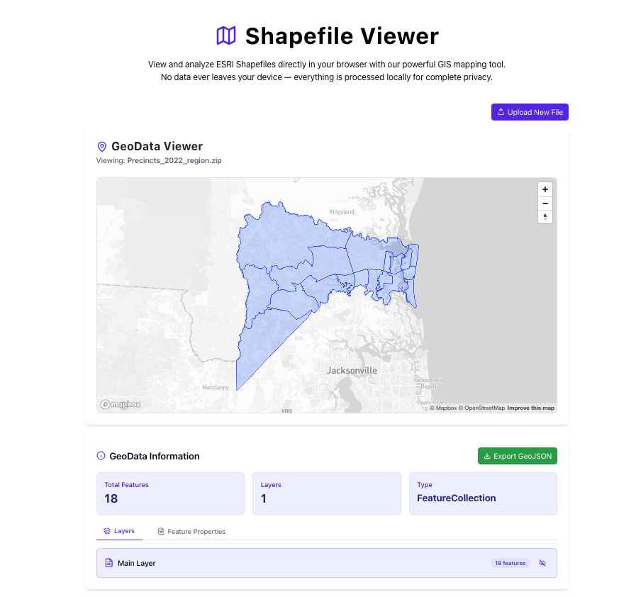
- Shapefile Viewer - Easily visualize ESRI Shapefiles directly in your browser
Why We Built These Tools #
Working with geographic data often requires specialized software or complex setups. We wanted to eliminate that friction and create something that just works instantly for anyone who needs to quickly view map data.
Our viewers process everything locally in your browser, meaning:
- Your data never leaves your device
- There's no waiting for server processing
- You can work with your files privately
Key Features #
Both viewers include:
- Interactive Maps - Pan, zoom, and explore your geodata with intuitive controls
- Feature Information - Click on any feature to see its properties and attributes
- Layer Styling - Basic visualization options to help you understand your data
- No Size Limits - Process files of any size your browser can handle
Use Cases #
- Quick Data Verification - Check if your GeoJSON or Shapefile contains the right information
- Sharing Geographic Data - Send someone a link to the viewer along with your file
- Field Work - View geospatial data directly on a mobile device without installing GIS software
- Data Exploration - Quickly examine data properties and geographic distribution
Try them out today and let us know what you think! We're constantly working to improve our data tools based on your feedback.
Why two formats? #
Shapefile 📦 #
Created by ESRI in the 1990s, a Shapefile actually comes as three–seven files (.shp, .shx, .dbf, etc.) zipped together. It's still everywhere—county parcel maps, census layers, engineering drawings—because legacy GIS software runs on it.
GeoJSON 🌐 #
GeoJSON is a single text‑based JSON file that stores geometry and properties inline. It's lightweight, web‑native, and plays nicely with modern JavaScript libraries like Leaflet and Mapbox GL.
| Feature | Shapefile | GeoJSON |
|---|---|---|
| Storage | Multiple binary files | One plain‑text file |
| Size | Smaller on disk | Larger but human‑readable |
| Web‑friendly | Needs conversion | Directly embeddable |
| Common use | Government & legacy GIS | Web apps, APIs, GitHub |
Meet the viewers #
| Viewer | Opens | What you can do |
|---|---|---|
| Shapefile Viewer | .zip bundles of Shapefiles |
Drag‑and‑drop, pan/zoom, inspect attribute table |
| GeoJSON Viewer | .geojson / .json |
Instant map, property pop‑ups, copy feature JSON |
Both tools run entirely in‑browser. Your data never leaves your machine.
Try them out #
Feedback shapes what we build next—drop your thoughts any time!